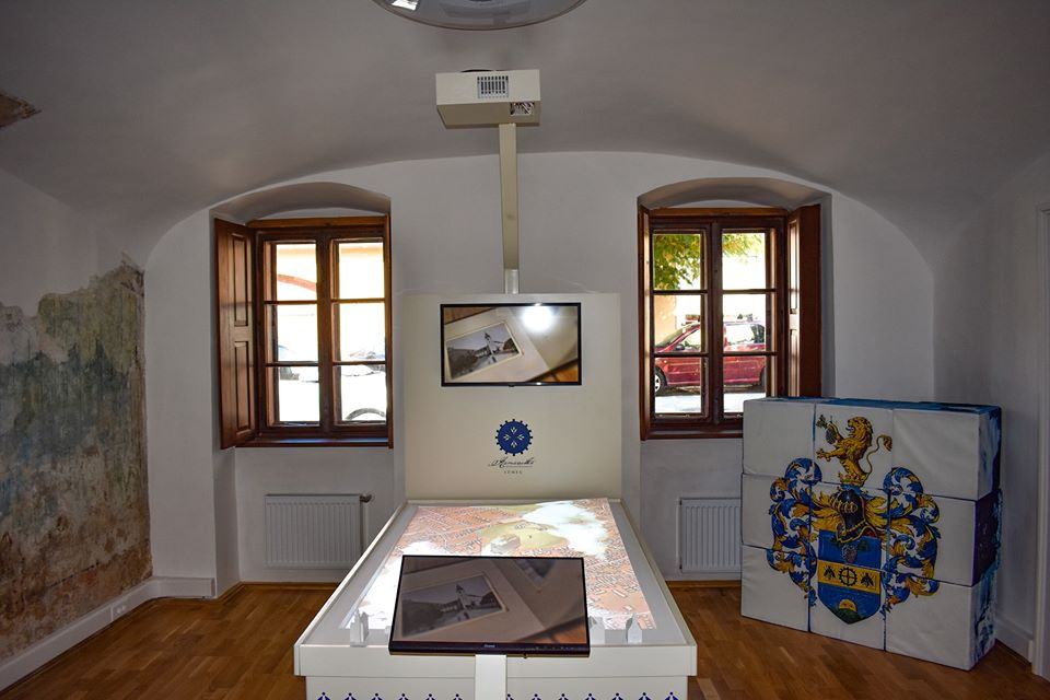
Mecsek Mountan mixed realtiy table
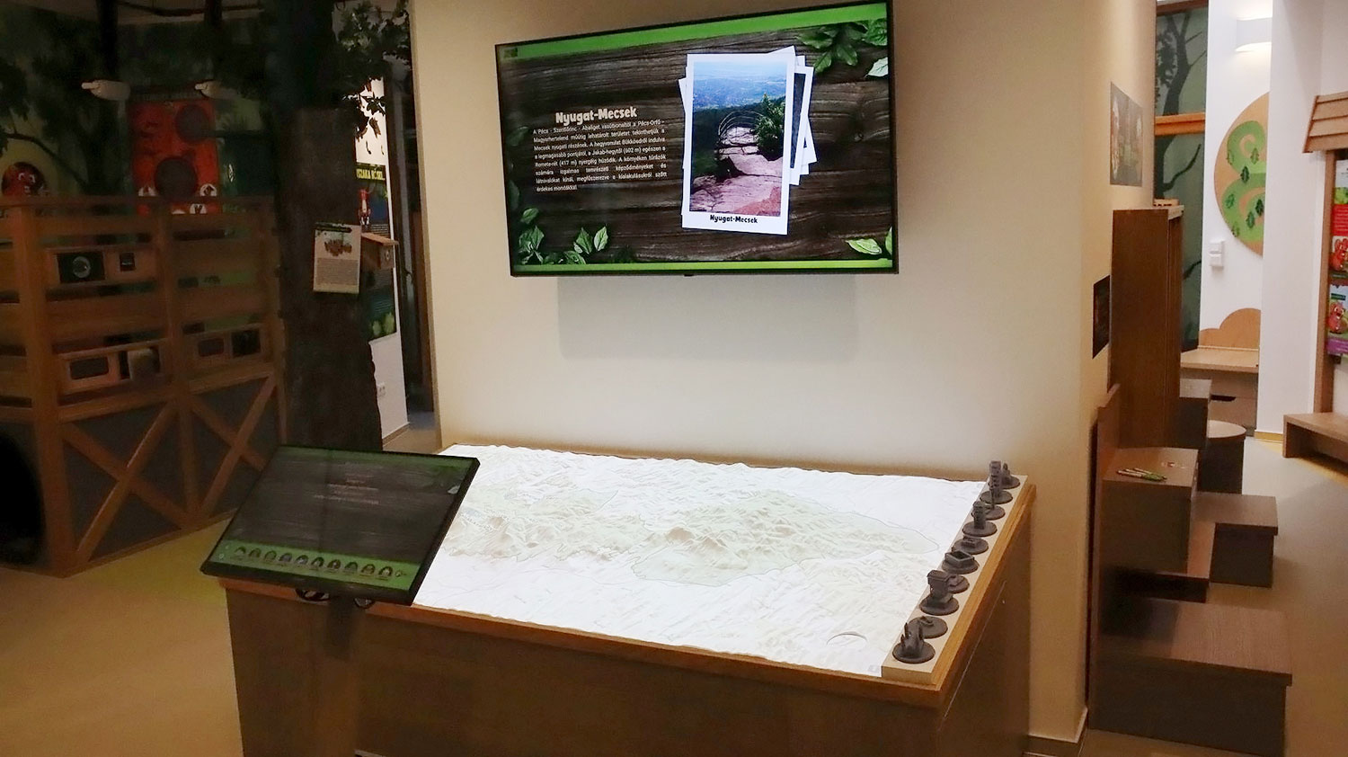
DIVIT digital field table at the MecseXplorer exhibition in the Mecsek Discovery Center.
DIVIT digital field table at the MecseXplorer exhibition in the Mecsek Discovery Center.
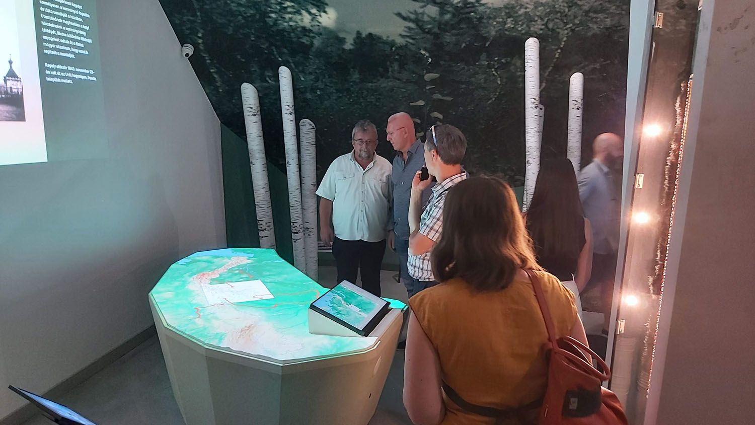
Ural digital field table at the Regulyverzum permanent exhibition in Zirc
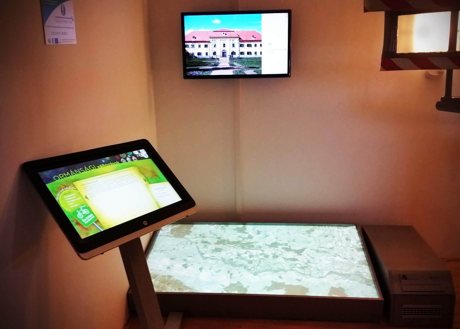
Ancient-Drava Programme Thematic Drava mapping project, combining a geo-spatial application with multimedia content and a novel look and feel on the DiVit Digital Terrain Table.
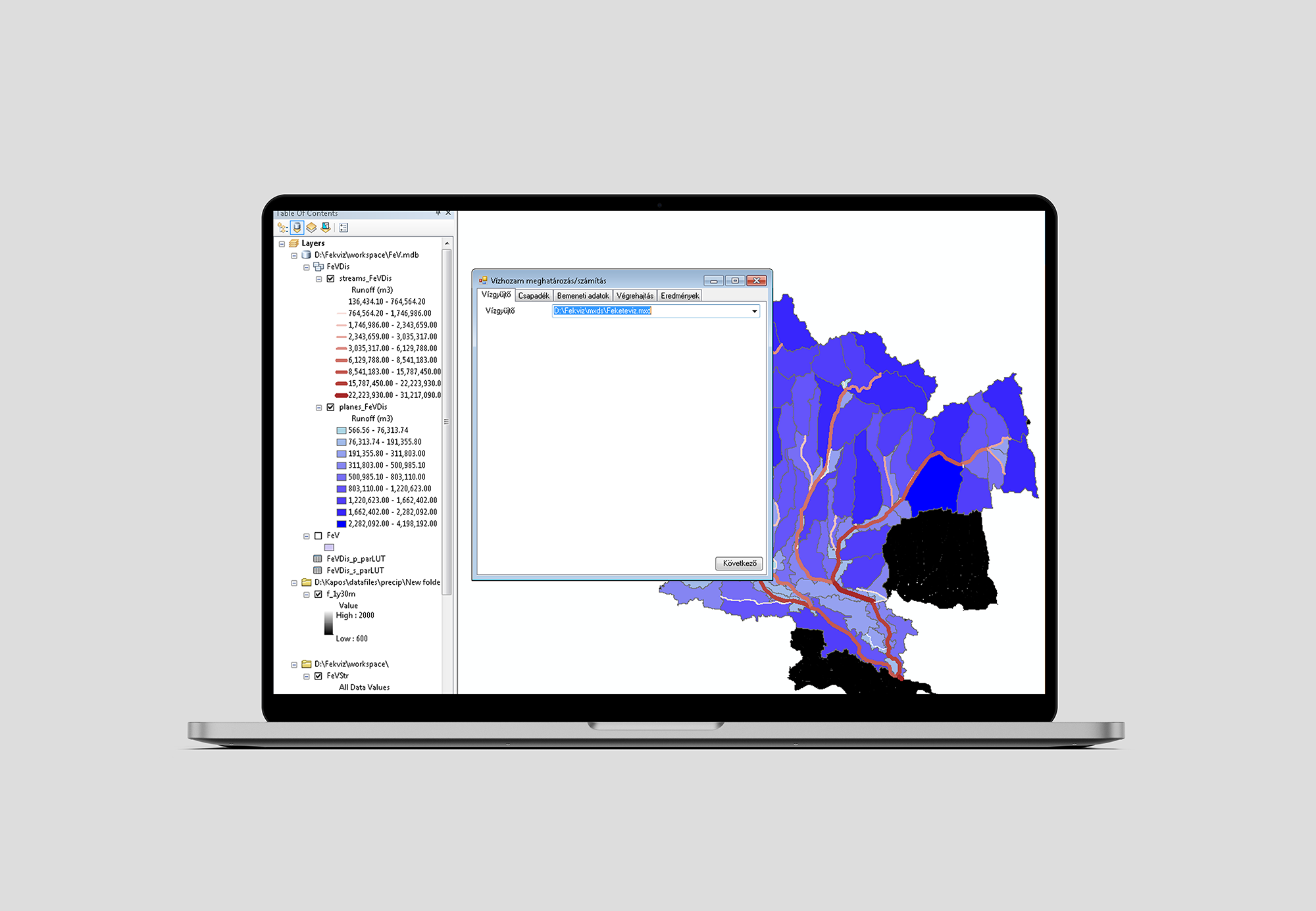
Predicting the peak discharge of mountain and hill floods using existing hydrographic station datasets and geospatial methods.
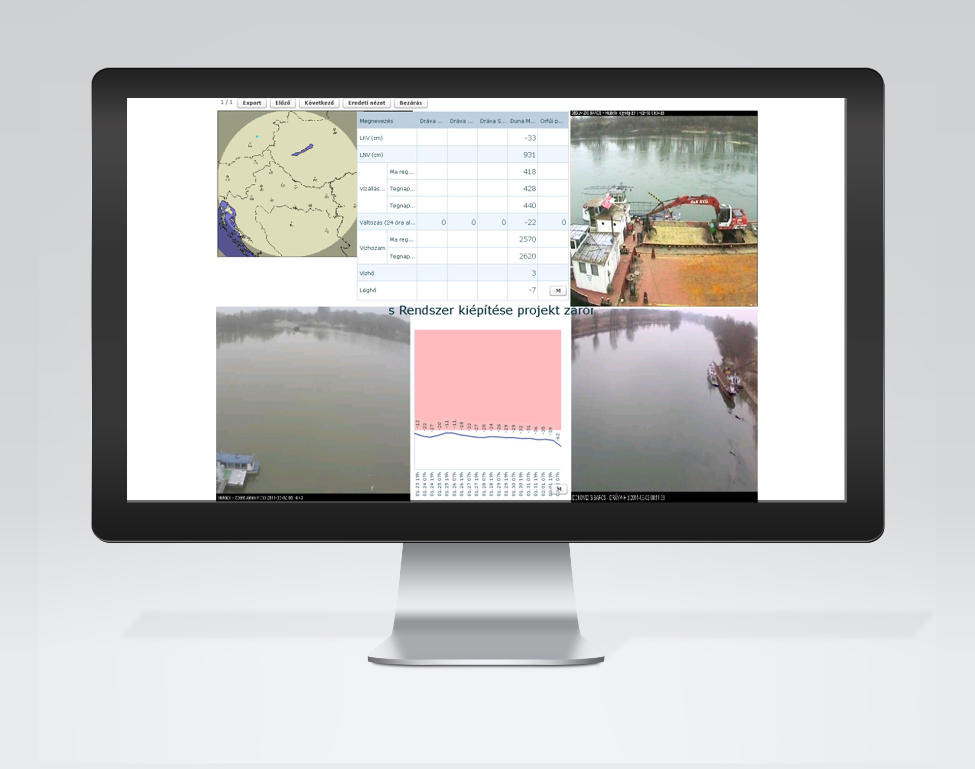
DDVIR – Development of the South Transdanubian Water Information System

Development and implementation of the Pallium geo-data-based archival registration system at the Baranya County Archives in the framework of the Baross Gábor programme.